Geological Heritage of the Island of Mljet
( View from the Grabova Glava hill ) |
Mljet, one of the most beautiful Adriatic islands, strikes from ENE to WSW, parallel to the Adriatic coast. It is elongate in shape, 3 km wide, and up to 37 km long. NW part of the island, proclaimed the National Park in 1960, besides its diverse ecosystem, exhibits a variety of geological features and interesting relief forms, as the result of exogenous and endogenous influences to the geological background. Cliffs, rocks and islets can be observed from the central ridge, particularly from the highest tops: Veliki Planjak (391 m) and Grabova glava (384 m).
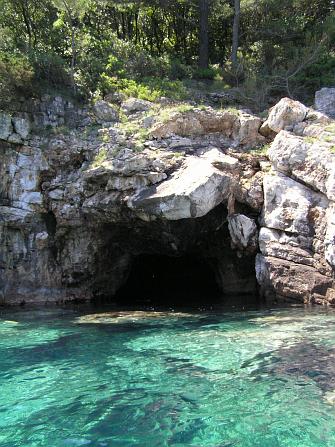
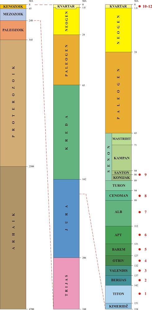
Along the coast, and in the central heights, several speleological objects were discovered. One of the caves was named after the famous Greek warrior Ulysses (Odysseus), as legend says Mljet was one of his stops on the way home from the Trojan War. Karst fields in the central part of the island are grown with figs, olives and vineyards. Particularly interesting are "Blatine" - muddy brackish ponds, which temporarily dry up. Veliko jezero (=Large lake), covering the area of 145 hectares, up to 46 m deep, and Malo jezero (=Small lake), 24 hectares large and up to 29 m deep, represent unique geological and oceanographic phenomena in Karst regions. These lakes are geologically young, at their early phase, ca. 10 000 years ago, they were filled with fresh water, while today they communicate with the open sea, and are inhabited with marine biota.Most of the marine sedimentary rocks in the National Park Mljet are limestones and dolomites of Jurassic (blue) and Cretaceous (green) age. They were deposited on the Adriatic Carbonate Platform, in time span from 150 million years to 80 million years before today. Adriatic Platform was a part of the African plate during the Paleozoic Era, but it broke apart and traveled towards the North. During the Jurassic, and Early Cretaceous it was situated at the latitude similar to recent Turkey. Platform was composed of numerous islands, islets, beaches, shallows and lagoons. Warm and shallow sea enabled flourishing of numerous biota. The most common were calcareous algae in protected and lagoonal environments, and peculiar bivalves, rudists, in open, more agitated shallows. Several other organisms were also present, from unicellular foraminifera, through corals, hydrozoans, gastropods, bryozoans, sea-urchins, up to marine vertebrates. Waves were destroying carbonate skeletons of dead biota, producing carbonate sand and mud. Depositionary basin was slowly sinking, but this process was compensated with input of new carbonate material. All together, during the existence of the platform, a thick sequence of 5 - 8 kilometers of carbonate rocks was deposited. Pressure of the African Plate traveling towards the North caused the formation of large mountain chains, from Alps and Dinarides, to Himalayas. In this tectonical process, Adriatic Carbonate Platform, cradle of our Karst Dinarides, disappeared ca. 40 million years ago. During the ice age of the Quaternary Period sea level dropped, and Northern Adriatic Basin dried out. We can see numerous cave objects from that period along the Adriatic coast and on the islands. Cave deposits and fluvial clastic sedimentary rocks are present at the territory of the National Park Mljet, and on the eastern edge of the island.Tectonically, the whole island represents a folded structure, with axis parallel to the coast. Numerous faults, particularly those perpendicular to the coast, are marked on the map with red lines.
( Geological map of the Mljet Island; Basic Geological Map, sheets Korčula and Ston ) |
GEOLOGICAL HERITAGE OF THE ISLAND OF MLJET is a program having roots in the first Natural heritage project of Mljet National Park, initiated in 1997 by Marin Perković. Geological ideas were discussed with Academician Ivan Gušić. The first rock samples were collected by the team of Croatian Geological Institute, Dubravko Matičec, Ladislav Fuček, and Antun Husinec (now teaching at St. Lawrence University). Geological team collected ten rock samples from different geological periods, performed micropaleontological and sedimentological analyses, and proposed the first model for the geological locality.
|